http://www.groundwatersoftware.com/didger.htm
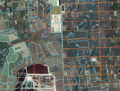
Digital orthoquarter quads (DOQQ) are aerial photographs that have been modified to Cartesian coordinates or UTM coordinates. Distortion among aerial photographs can occur because some features such as mountains (higher elevations) show more detail whereas features at sea level will be more distorted. Also, features that are not centralized within the photo are not aligned with the base so distortion can occur. A DOQQ accounts for these distortions through a process of orthorectification, where ground features are shown in their true position which creates more accuracy. In the DOQQ shown above, data is shown with different colors; blue representing hydrography and orange representing roads.
No comments:
Post a Comment